 Matson Insurance has partnered with Jefferson County History Center to offer exploreJeffersonpa.com readers a look into Jefferson County’s past. Today, tbe Seven Hills of Brookville is highlighted.
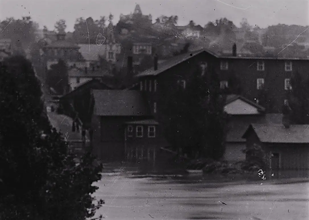
[Pictured above: Looking across the Red Bank during the 1936 flood, Brookville’s Central School building sits high up on “Knowledge Knob,” one of the seven hills that surround Brookville. (JCHS Collection)]
Submitted by Carole Briggs:
SEVEN HILLS OF BROOKVILLE
A century ago, it was easy to see Brookville’s Central School from most parts of town. Then it was an easy landmark and folks called the area Schoolhouse Hill or Knowledge Knob.
Another easy landmark, Immaculate Conception Roman Catholic Church, was built in 1872, marking that hilltop as Catholic Hill. When the railroad tunnel was constructed, that hill became known as Tunnel Hill. Thus, four of Brookville’s seven hills are named by their structures: Hospital Hill (once known as Pigeon Hill), Schoolhouse Hill or Knowledge Knob, Catholic Hill, and Tunnel Hill.
The three remaining hills? Litch Hill perhaps. 322 West perhaps. And even 322 East!

Reference points, be they natural or manmade make for an interesting read sometimes. A letter in our collection, written by George Meck sometime after the Civil War, uses both physical and man-made points of location. He and his family had moved to Kansas and he wanted his good friend, James Kennedy, to visit him.
“I will tell you how to come here. You will take the cars [railroad] at Pittsburgh then come to Chicago, Illinois, then come to Quincy on the Mississippi River, then cross the river there, and then take the railroad to St. Joseph MO, then go on at the end of the railroad you will cross the river there into Kansas. I live 20 miles from there. The stage runs in sight of my house. Get on the stage at St. Joseph and come to Walnut Grove post office then you are in sight of my house….You can come all the way by water. You could come down the Ohio River to Cairo then come up the Mississippi to St. Louis, then come up the Missouri River to St. Joseph but you had better come on the railroad to St. Joseph then get on the Stage. And come to Walnut Grove P.O.”
Today locations all over the globe are marked through the Global Positioning System (GPS). Volunteers from the Society for Pennsylvania Archaeology (North Fork Chapter 29) and others used GPS to document the “Dedicated Rocks” of Douglas Monroe Stahlman.
Stahlman had a religious experience in 1908 that led him to inscribe more than 530 rocks and trees with Biblical verses, reference dates, and personal opinions. In 1917 he was admitted to Dixmont mental institution, dying there in 1942. His rocks are featured in the Scripture Rocks Heritage Park just north of Brookville.
We have to admit that using the Global Positioning System makes much more sense than simply saying, “Well, you’ll find that group of rocks halfway down the path along the old railbed,” but perhaps you are willing to admit that “just below Knowledge Knob” sounds much more picturesque.
Copyright@Jefferson County Historical Society, Inc.
Throwback Thursday is brought to you by Matson Insurance in Brookville.
Submitted by the Jefferson County History Center.
Copyright © 2024 EYT Media Group, Inc. All rights reserved. Any copying, redistribution or retransmission of the contents of this service without the express written consent of EYT Media Group, Inc. is expressly prohibited.


