 Matson Insurance is partnering with Jefferson County History Center to offer exploreJeffersonpa.com readers a look in Jefferson County’s past. Today “Waterways in Jefferson County” is being showcased.
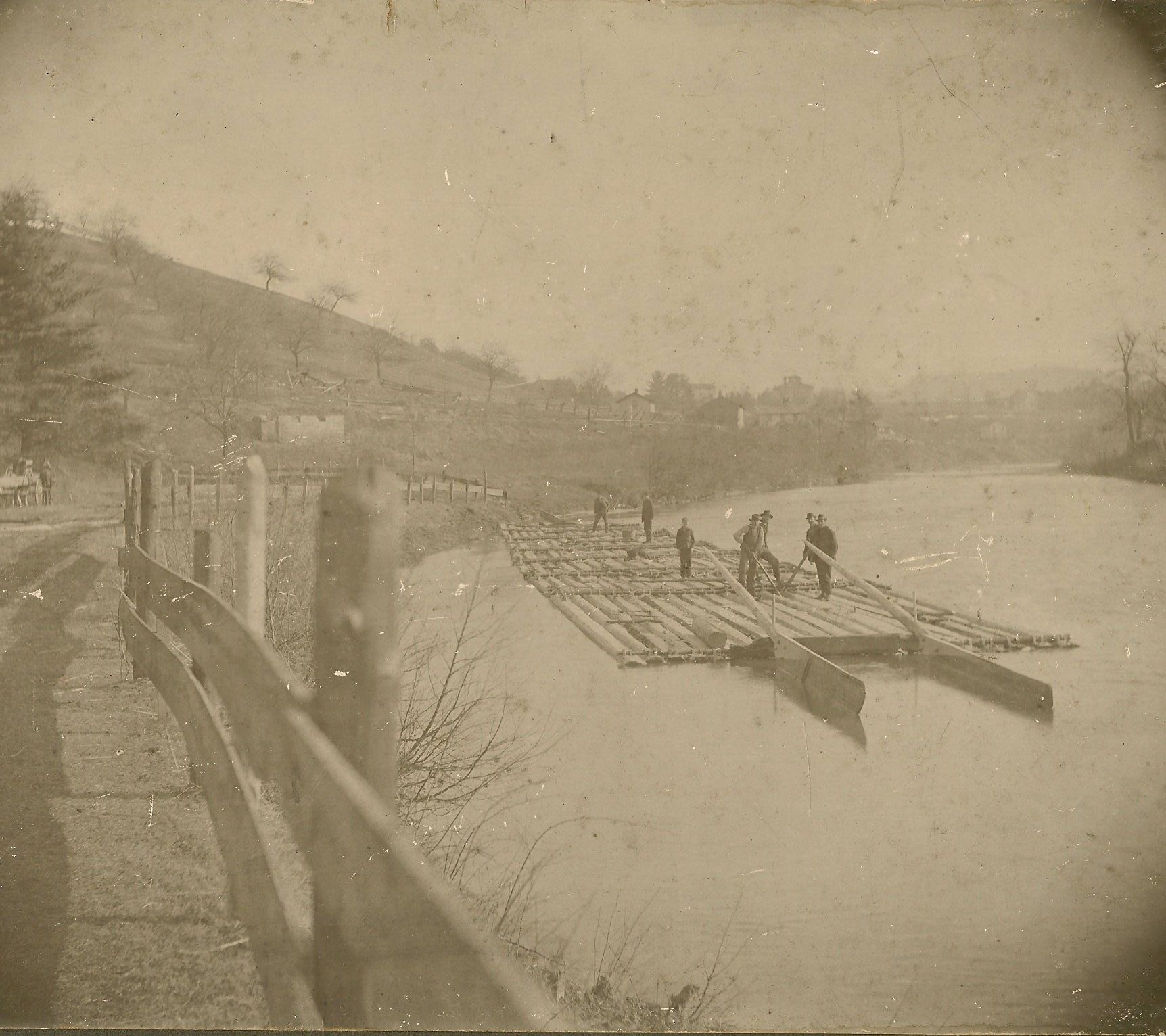
[Photo: The headwaters of Sandy Lick are in Clearfield County. It merges with the North Fork in Brookville to form Redbank Creek, a waterway that empties into the Allegheny River. (JCHS Collection)]
The following article was written by Carole A. Briggs, Curator, Jefferson County History Center:
RUNS, LICKS, AND CREEKS
The naming of places takes many forms from many sources―the physical description of the area, the people who’ve made an impact in an area, or even an event that occurred in an area. Soldier Run, for instance, supposedly gets its name because it’s in the area where soldiers once camped.
How about the nouns used for waterways? An 1866 map uses river, fork, creek, run, branch, and lick. McKnight adds the noun branchlet. Run, branch, and creek all describe waterways smaller than rivers. Lick would indicate the sa-line or salt deposit. Creek, in the dictionary, rhymes with seek, however as part of our delightful regional dialect, many folks pronounce it as “crick.” That word means a neck or back spasm!
The Native Americans of years gone by named waterways by their physical description. For example, Gawunsch-hanne or Brier Stream denotes the Clarion River, a waterway whose banks were overgrown with green briers. The North Fork was called “Tangawunsch-hanne,” which meant Little Brier Stream.
Mahonne (Mahoning) designated a lick, a saline or salt deposit frequented by the many deer, elk, and buffalo in the area. The smaller Sandy Lick was called Legamwi-mahonne.
Some English names of waterways are descriptive, too. Clear Creek is usually clear (and cold), and you know what borders Pine Creek, Clover Run, and Laurel Run! Rock Run and Stony Run are also quite descriptive. Runs named after wildlife include Elk, Rattlesnake, Trout, and Wolf.
Stump Creek was most likely named when most of the trees had been cut, Sugar Camp Run for the annual place to “sugar off,” and Indian Camp Run is near Punxsutawney, the sight of documented gatherings of Native Americans. Five and Six Mile Runs describe their length, but does the big in Big Run describe its length or its breadth? Directionally named waterways include the East Branch, South Branch, and North Fork.
Many waterways retain the names of the early timber men who built mills on them―timber men with names like Callen, Cather, Craft, Coder, Hetrick, and Lucas. They built mills on streams that could both power the mills and float timber and boards downstream. John Matson ran timber in 1805 and Matson Run carries his name.
And then there is the plain and simple Mill Creek that flows into the Sandy Lick at Port Barnett, the site of the first mill in the county, the mill built by Joseph Barnett and his relatives prior to 1800.
Copyright@Jefferson County Historical Society, Inc.
Throwback Thursday is brought to you by Matson Insurance in Brookville.

Submitted by the Jefferson County History Center.
Copyright © 2024 EYT Media Group, Inc. All rights reserved. Any copying, redistribution or retransmission of the contents of this service without the express written consent of EYT Media Group, Inc. is expressly prohibited.


