 JEFFERSON CO., Pa. (EYT) – A Heat Advisory remains in effect for Jefferson County and surrounding areas.
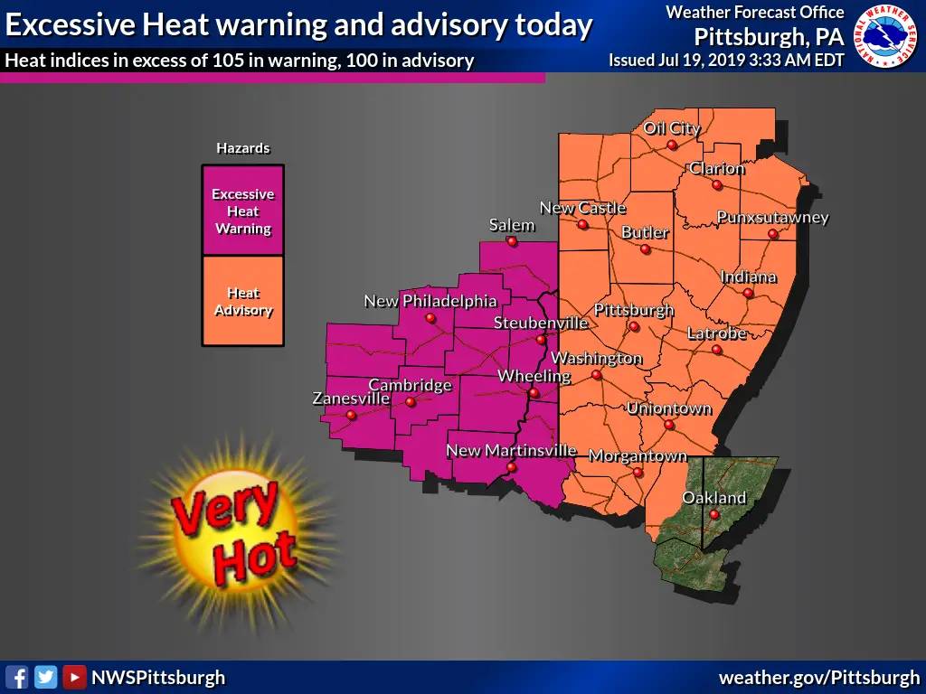
The National Weather Service of Pittsburgh issued the following Urgent Weather Message at 4:06 a.m. on Friday, July 19, 2019:
Heat Advisory
URGENT – WEATHER MESSAGE
National Weather Service Pittsburgh PA
406 AM EDT Fri Jul 19 2019
COUNTIES:
Mercer-Venango-Forest-Lawrence-Butler-Clarion-Jefferson PA-Beaver-Allegheny-Armstrong-Indiana-Washington-Greene-Westmoreland-Westmoreland Ridges-Fayette-Fayette Ridges-Marion-Monongalia-Ridges of Eastern Monongalia and Northwestern Preston-Preston-
CITIES:
Including the cities of Sharon, Hermitage, Grove City, Oil City, Franklin, Tionesta, New Castle, Ellwood City, Butler, Clarion, Punxsutawney, Brookville, Aliquippa, Beaver Falls, Ambridge, Monaca, Pittsburgh Metro Area, Kittanning, Ford City, Indiana, Washington, Canonsburg, Waynesburg, Murrysville, Greensburg, New Kensington, Ligonier, Donegal, Uniontown, Champion, Ohiopyle, Fairmont, Morgantown, Coopers Rock, Kingwood, and Bruceton Mills
406 AM EDT Fri Jul 19 2019
…HEAT ADVISORY REMAINS IN EFFECT FROM NOON TODAY TO 8 PM EDT SATURDAY…
* HEAT INDEX VALUES…Up to 104 due to temperatures in the lower 90s, and dewpoints in the lower 70s.
* TIMING…this afternoon into early evening, and again Saturday afternoon into early evening.
* IMPACTS…The heat and humidity may cause heat stress during outdoor exertion or extended exposure.
PRECAUTIONARY/PREPAREDNESS ACTIONS…
If you work or spend time outside. When possible, reschedule strenuous activities to early morning or evening. Know the signs and symptoms of heat exhaustion and heat stroke. Wear light-weight and loose-fitting clothing when possible and drink plenty of water.
Copyright © 2024 EYT Media Group, Inc. All rights reserved. Any copying, redistribution or retransmission of the contents of this service without the express written consent of EYT Media Group, Inc. is expressly prohibited.


