 JEFFERSON CO., Pa. (EYT) – A Special Weather Statement has been issued for Clarion County and surrounding areas.
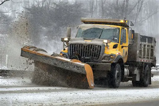
(PHOTO: A Pennsylvania Department of Transportation truck plows snow from an overpass. AP Photo/Keith Srakocic.)
The National Weather Service of Pittsburgh issued the following Special Weather Statement at 8:54 a.m. on Wednesday, February 13, 2019:
Special Weather Statement
National Weather Service Pittsburgh PA
854 AM EST Wed Feb 13 2019
COUNTIES:
Garrett- Tuscarawas- Carroll- Columbiana- Coshocton- Harrison- Jefferson OH- Muskingum- Guernsey- Belmont- Noble- Monroe- Mercer- Venango- Forest- Lawrence- Butler- Clarion- Jefferson PA- Beaver- Allegheny-Armstrong- Indiana- Washington- Greene- Westmoreland- Westmoreland Ridges- Fayette- Fayette Ridges- Hancock- Brooke- Ohio- Marshall- Wetzel- Marion- Monongalia- Ridges of Eastern Monongalia and Northwestern Preston- Preston- Eastern Preston- Western Tucker- Eastern Tucker
CITIES:
Including the cities of Mountain Lake Park, Oakland MD, Grantsville, New Philadelphia, Dover, Carrollton, Malvern, East Liverpool, Salem, Columbiana, Coshocton, Cadiz, Steubenville, Zanesville, Cambridge, Martins Ferry, St. Clairsville, Caldwell, Woodsfield, Sharon, Hermitage, Grove City, Oil City, Franklin, Tionesta, New Castle, Ellwood City, Butler, Clarion, Punxsutawney, Brookville, Aliquippa, Beaver Falls, Ambridge, Monaca, Pittsburgh Metro Area, Kittanning, Ford City, Indiana, Washington, Canonsburg, Waynesburg, Murrysville, Greensburg, New Kensington, Ligonier, Donegal, Uniontown, Champion, Ohiopyle, Weirton, Follansbee, Wellsburg, Wheeling, Moundsville, New Martinsville, Fairmont, Morgantown, Coopers Rock, Kingwood, Bruceton Mills, Terra Alta, Rowlesburg, Hazelton, Parsons, Hendricks, Saint George, Davis, Thomas, and Canaan Valley.
854 AM EST Wed Feb 13 2019
…LOW VISIBILITIES AND ICY ROADS THIS MORNING…
Snow showers moving across the region this morning may be briefly moderate to heavy, dropping visibilities to one half mile or less, and producing a quick half inch of snow accumulation. Also, water remaining on roads from the rain yesterday has frozen in many areas. This combination is creating very slick driving conditions.
If you are driving this morning, use extreme caution. Slow down and increase the distance between your car and the ones ahead of you. Allow extra time to reach your destination.
Copyright © 2024 EYT Media Group, Inc. All rights reserved. Any copying, redistribution or retransmission of the contents of this service without the express written consent of EYT Media Group, Inc. is expressly prohibited.


