 JEFFERSON CO., Pa. (EYT) – A Wind Advisory has been issued for Jefferson County and surrounding areas.
The National Weather Service of Pittsburgh issued the following URGENT WEATHER MESSAGE AT 4:59 a.m. on Saturday, December 11, 2021:
Wind Advisory
URGENT – WEATHER MESSAGE
National Weather Service Pittsburgh PA
459 AM EST Sat Dec 11 2021
COUNTIES:
Tuscarawas-Carroll-Columbiana-Coshocton-Harrison-Jefferson OH-Muskingum-Guernsey-Belmont-Noble-Monroe-Mercer-Venango-Forest-Lawrence-Butler-Clarion-Jefferson PA-Beaver-Allegheny-Armstrong-
Indiana-Washington-Greene-Westmoreland-Higher Elevations of Westmoreland-Fayette-Higher Elevations of Fayette-Hancock-Brooke-Ohio-Marshall-Wetzel-Marion-Monongalia-Ridges of Eastern Monongalia and Northwestern Preston-Preston-Eastern Preston-Western Tucker-Eastern Tucker-
CITIES:
Including the cities of New Philadelphia, Dover, Carrollton, Malvern, East Liverpool, Salem, Columbiana, Coshocton, Cadiz, Steubenville, Zanesville, Cambridge, Martins Ferry, St. Clairsville, Caldwell, Woodsfield, Sharon, Hermitage, Grove City, Oil City, Franklin, Tionesta, New Castle, Ellwood City, Butler, Clarion, Punxsutawney, Brookville, Aliquippa, Beaver Falls, Ambridge, Monaca, Pittsburgh Metro Area, Kittanning, Ford City, Indiana, Washington, Canonsburg, Waynesburg, Murrysville, Greensburg, New Kensington, Lower Burrell, Latrobe, Monessen, Ligonier, Donegal, Uniontown, Champion, Ohiopyle, Weirton, Follansbee, Wellsburg, Wheeling, Moundsville, New Martinsville, Fairmont, Morgantown, Coopers Rock, Kingwood, Bruceton Mills, Terra Alta, Rowlesburg,
Hazelton, Parsons, Hendricks, Saint George, Davis, Thomas, and Canaan Valley
459 AM EST Sat Dec 11 2021
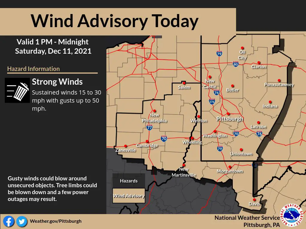
…WIND ADVISORY REMAINS IN EFFECT FROM 1 PM THIS AFTERNOON TO MIDNIGHT EST TONIGHT…
* WHAT…West winds 15 to 25 mph with gusts up to 50 mph expected.
* WHERE…Portions of northwest, southwest and western Pennsylvania, east central Ohio and northern and the northern panhandle of West Virginia.
* WHEN…From 1 PM this afternoon to midnight EST tonight.
* IMPACTS…Gusty winds could blow around unsecured objects. Tree limbs could be blown down and a few power outages may result.
PRECAUTIONARY/PREPAREDNESS ACTIONS…
Use extra caution when driving, especially if operating a high-profile vehicle. Secure outdoor objects.
Copyright © 2024 EYT Media Group, Inc. All rights reserved. Any copying, redistribution or retransmission of the contents of this service without the express written consent of EYT Media Group, Inc. is expressly prohibited.


