 JEFFERSON CO., Pa. (EYT) – A Winter Storm Warning and a Flood Warning remain in effect for Jefferson County and surrounding areas.
The National Weather Service of Pittsburgh issued the following Flood Warning at 5:46 p.m. on Friday, January 18, 2018:
Flood Warning
Flood Statement
National Weather Service Pittsburgh PA
546 PM EST Fri Jan 12 2018
…The flood warning continues for the following rivers in Pennsylvania…
Clarion River At Cooksburg affecting Clarion…Forest and Jefferson Counties.
.Insert basis/synopsis section here…Runoff from the heavy rain will maintain an elevated river this evening.
PRECAUTIONARY/PREPAREDNESS ACTIONS…
SAFETY MESSAGE: Do not drive through flooded areas. The water may be deeper than it appears. Stay tuned to NOAA Weather radio for later developments.
RIVER FLOOD WARNING
546 PM EST Fri Jan 12 2018
The River Flood Warning continues for,
The Clarion River At Cooksburg.
* Until Saturday morning, or until the warning is canceled.
* At 5:00 PM Friday the stage was 13.5 feet.
* Flood stage is 13.0 feet.
* Minor flooding is occurring and Minor flooding is forecast.
* Forecast…The river will remain steady or vary around
13.5 feet this evening. The river will fall below flood stage after midnight tonight.
* Impact…At 14.0 feet, About 1 foot of water covers River Road near the Cook Forest State Park office.
The National Weather Service of Pittsburgh issued the following Flood Warning at 5:21 p.m. on Friday, January 12, 2018:
Flood Warning
Flood Warning
National Weather Service Pittsburgh PA
521 PM EST FRI JAN 12 2018
Washington PA-Beaver PA-Venango PA-Lawrence PA-Indiana PA-Butler PA-Allegheny PA-Jefferson PA-Westmoreland PA-Armstrong PA-Clarion PA-Forest PA-
521 PM EST FRI JAN 12 2018
The National Weather Service in Pittsburgh has issued a
* Flood Warning for…
Rain and Snowmelt in…
East central Washington County in southwestern Pennsylvania…
Beaver County in western Pennsylvania…
Venango County in northwestern Pennsylvania…
Lawrence County in western Pennsylvania…
Northwestern Indiana County in west central Pennsylvania…
Butler County in west central Pennsylvania…
Allegheny County in southwestern Pennsylvania…
Western Jefferson County in west central Pennsylvania…
Northwestern Westmoreland County in southwestern Pennsylvania…
Armstrong County in west central Pennsylvania…
Clarion County in west central Pennsylvania…
Forest County in northwestern Pennsylvania…
* Until 515 AM EST Saturday.
* At 517 PM EST, radar and observations indicated rain transitioning to freezing rain and snow over the warned area. Runoff from the 2 to 3 inches of rainfall over the past 24 hours will continue. Ice jams remain a threat on small streams as well as area rivers.
Water should begin to recede later tonight and into Saturday as liquid precipitation ends.
Please report flooding by calling 412-262-1988, posting to the NWS Pittsburgh Facebook page, or using Twitter @NWSPITTSBURGH.
PRECAUTIONARY/PREPAREDNESS ACTIONS…
Turn around, don`t drown. Most flood fatalities occur in vehicles.
FLOOD WATCH
Flood Watch
National Weather Service Pittsburgh PA
550 PM EST Fri Jan 12 2018
Tuscarawas-Carroll-Columbiana-Coshocton-Harrison-Jefferson-Muskingum-Guernsey-Belmont-Noble-Monroe-Mercer-Venango-Forest-Lawrence-Butler-Clarion-Beaver-Allegheny-Armstrong-Indiana-Washington-Greene-Westmoreland-Westmoreland Ridges-Fayette-Fayette Ridges-Hancock-Brooke-Ohio-Marshall-Wetzel-Marion-Monongalia-Ridges of Eastern Monongalia and Northwestern Preston-Preston-Eastern Preston-
Including the cities of New Philadelphia, Dover, Carrollton, Malvern, East Liverpool, Salem, Columbiana, Coshocton, Cadiz, Steubenville, Zanesville, Cambridge, Martins Ferry, St. Clairsville, Caldwell, Woodsfield, Sharon, Hermitage, Grove City, Oil City, Franklin, Tionesta, New Castle, Ellwood City, Butler, Clarion, Punxsutawney, Brookville, Aliquippa, Beaver Falls, Ambridge, Monaca, Pittsburgh Metro Area, Kittanning, Ford City, Indiana, Washington, Canonsburg, Waynesburg, Murrysville, Greensburg, New Kensington, Ligonier, Donegal, Uniontown, Champion, Ohiopyle, Weirton, Follansbee, Wellsburg, Wheeling, Moundsville, New Martinsville, Fairmont, Morgantown, Coopers Rock, Kingwood, Bruceton Mills, Terra Alta, Rowlesburg, and Hazelton
550 PM EST Fri Jan 12 2018
…FLOOD WATCH REMAINS IN EFFECT THROUGH SATURDAY AFTERNOON…
The Flood Watch continues for
* Portions of east central Ohio, Pennsylvania, and West Virginia.
* Through Saturday morning.
* Runoff from the 2 to 3 inches of rainfall will combine with possible ice jams to maintain a flood threat.
PRECAUTIONARY/PREPAREDNESS ACTIONS…
A Flood Watch means there is a potential for additional flooding.
You should monitor later forecasts and take action if Flood Warnings are issued or already in effect for your area. Those living in areas prone to flooding should be prepared to take action should flooding develop.
HAZARDOUS WEATHER OUTLOOK
Hazardous Weather Outlook
National Weather Service Pittsburgh PA
258 PM EST Fri Jan 12 2018
Tuscarawas-Carroll-Columbiana-Coshocton-Harrison-Jefferson-Muskingum-Guernsey-Belmont-Noble-Monroe-Mercer-Venango-Forest-Lawrence-Butler-Clarion-Beaver-Allegheny-Armstrong-Washington-Hancock-Brooke-Ohio-
258 PM EST Fri Jan 12 2018
…FLOOD WATCH IN EFFECT THROUGH SATURDAY AFTERNOON…
…WINTER STORM WARNING IN EFFECT UNTIL 10 AM EST SATURDAY…
This Hazardous Weather Outlook is for east central Ohio, northwest Pennsylvania, southwest Pennsylvania, west central Pennsylvania,western Pennsylvania, northern West Virginia and northern panhandle of West Virginia.
.DAY ONE…This Afternoon and Tonight.
Please listen to NOAA Weather Radio or go to weather.gov on the Internet for more information about the following hazards.
Flood Watch.
Winter Storm Warning.
.DAYS TWO THROUGH SEVEN…Saturday through Thursday.
Please listen to NOAA Weather Radio or go to weather.gov on the Internet for more information about the following hazards.
Flood Watch.
Winter Storm Warning.
.SPOTTER INFORMATION STATEMENT…
Spotter activation is not expected at this time.
URGENT WINTER WEATHER MESSAGE
Winter Storm Warning
URGENT – WINTER WEATHER MESSAGE
National Weather Service Pittsburgh PA
237 PM EST Fri Jan 12 2018
…DANGEROUS TRAVEL CONDITIONS DEVELOPING THIS AFTERNOON INTO THIS EVENING…
.In the wake of unseasonably warm air and heavy rainfall, an arctic cold front will continue to blast across the area this afternoon. Temperatures will fall sharply from near 60 degrees into the 30s, ultimately falling into the teens by Saturday morning with wind chills near zero. As the colder air moves in, warm air aloft will result in a period of freezing rain.
Freezing rain, coupled with standing water, will result in a flash freeze this afternoon and evening. Ice accumulations could be significant enough to damage branches and power lines.
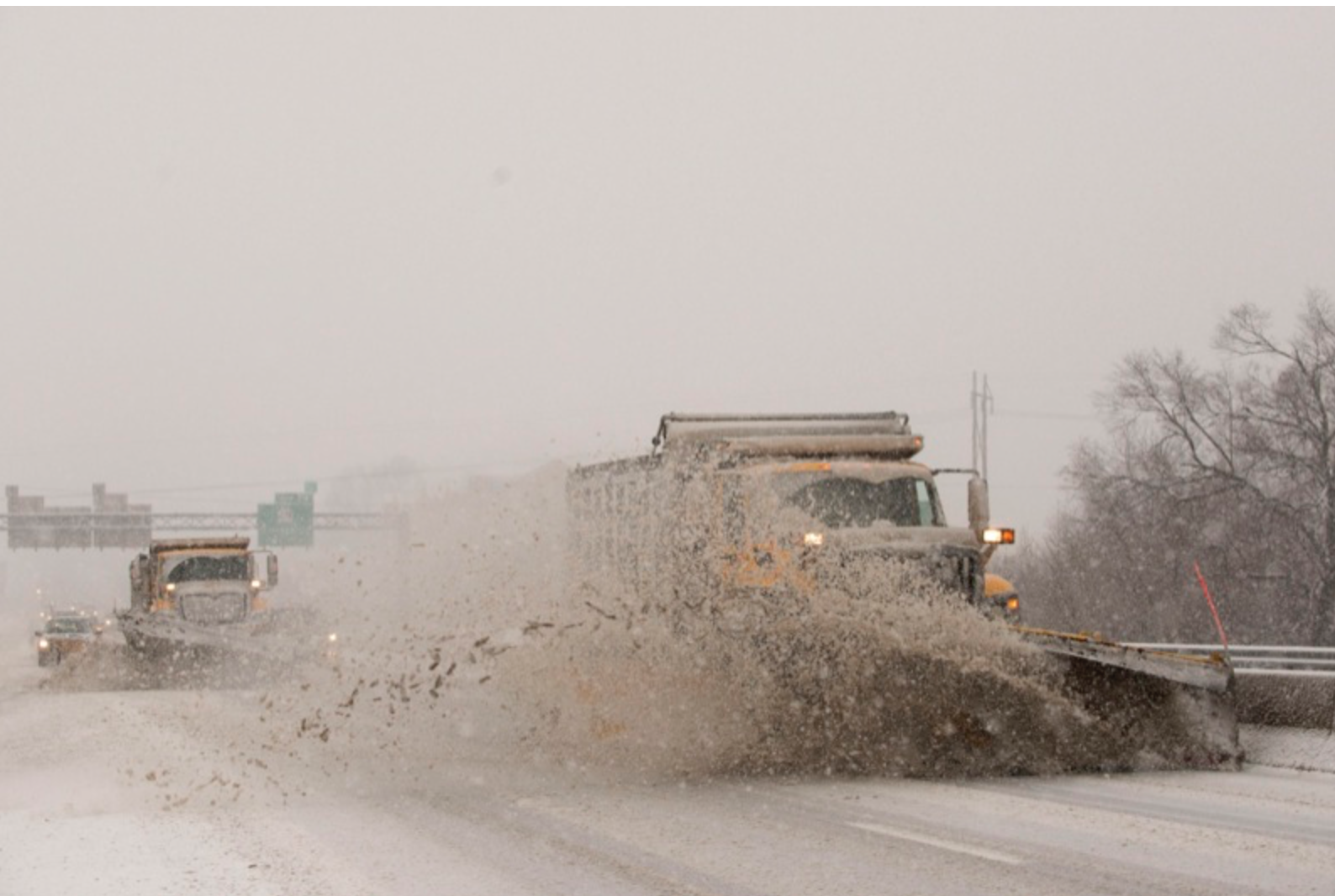
Freezing rain will then transition to a period of sleet before a complete changeover to snow this evening. Snow could be briefly heavy at times overnight. Accumulating snow on top of a sheet of ice will result in extremely dangerous if not impossible driving conditions into Saturday morning.
Mercer-Venango-Forest-Lawrence-Butler-Clarion-
Including the cities of Sharon, Hermitage, Grove City, Oil City, Franklin, Tionesta, New Castle, Ellwood City, Butler, and Clarion
237 PM EST Fri Jan 12 2018
…WINTER STORM WARNING REMAINS IN EFFECT UNTIL 10 AM EST SATURDAY…
* WHAT…Heavy mixed precipitation expected. Plan on difficult travel conditions. Total snow accumulations of 4 to 7 inches and ice accumulations of up to two tenths of an inch are expected.
* WHERE…Portions of northwest, west central and western Pennsylvania.
* WHEN…Until 10 AM EST Saturday.
* ADDITIONAL DETAILS…Sharply falling temperatures will result in a flash freeze of any standing water. Roads will quickly become slick and hazardous once temperatures fall below freezing.
PRECAUTIONARY/PREPAREDNESS ACTIONS…
A Winter Storm Warning means significant amounts of snow, sleet, and ice are expected. This will make travel very hazardous or impossible. The latest road conditions for the state you are calling from can be obtained by calling 5 1 1.
Copyright © 2024 EYT Media Group, Inc. All rights reserved. Any copying, redistribution or retransmission of the contents of this service without the express written consent of EYT Media Group, Inc. is expressly prohibited.


