 JEFFERSON CO., Pa. (EYT) – Those with an eye to the sky say the coming weekend could bring a significant amount of snow, rain, and freezing rain.
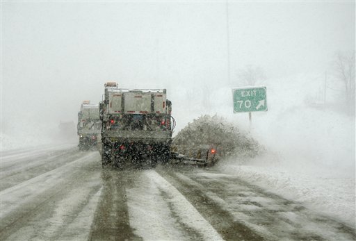
(PHOTO:A Pensylvania Department of Transportation snowplow train works to clear snow. AP Photo/Carolyn Kaster.)
Forecasters are currently tracking a possible Nor’easter which could bring significant snowfall to our area.
According to Accuweather’s John Gresiak, the storm that is currently brewing will most likely begin affecting our area by mid-day Saturday.
“The worst part is going to occur toward sundown on Saturday through Saturday night. We’re expecting it to start as snow, and I would say that the further north you go, it is most likely to be all snow,” Gresiak told exploreJeffersonPA.com.
Gresiak noted that according to the current models, and as we’ve seen in many past weather events, the Interstate 80 corridor will most likely be the cutoff point for which parts of the area will see entirely snow and which parts will see more of a wintery mix during parts of the storm.
“Further south, south of Interstate 80, you’re probably going to see the snow mix with and possibly change over to sleet and freezing rain for a time, and that’s going to occur during the time of the heaviest precipitation, overnight Saturday night,” Gresiak said.
“Then on Sunday morning, probably really early, everything will change back to all snow and then taper off through the day Sunday.”
According to Gresiak, though it is currently still too soon for them to say with certainty, it currently appears that the storm could drop some very heavy snow.
“I think we’re looking at much of the area getting six to twelve inches of snow, and in some of the areas to the north, parts of northern Venango County and Forest County, we could see up to fifteen inches. It’s definitely going to bring travel to almost a standstill across the area on Saturday night,” Gresiak said.
The snowfall isn’t the only weather concern ahead, either. According to Gresiak, a “blast of brutally cold air” is following behind the storm, ready to strike as soon as it passes.
“We are looking at some extreme cold on Sunday through Monday and into Tuesday,” Gresiak said.
Gresiak also noted that with the temperature dipping down around zero and the wind picking up a bit, sub-zero wind chills are a strong possibility.
“There will be a fair amount of wind Sunday into Monday, with wind chills at a dangerous level. If you’re going to be outdoors, you really need to be well-prepared and well-dressed. Don’t have any exposed skin out there.”
According to the National Weather Service, the temperature is expected to drop down around 27 degrees overnight tonight, with an 80% chance of snow showers.
The expected accumulation overnight is one to two inches.
There is a 30% chance of some snow Friday morning, mainly before 8:00 a.m. with the high for the day expected to be around 34 degrees. A 30% chance of continued show showers remains overnight Friday night, mainly after 4:00 a.m., with a low around 21 degrees.
The storm is expected to strike on Saturday beginning around noon. Saturday’s high should top out around 27 degrees, with wind gusts up to 21 miles per hour. Saturday night, the snow is expected to continue through the night and the overnight low should drop down around 18 degrees.
More snow is likely Sunday morning, mainly before 8:00 a.m., tapering to snow showers between 8:00 a.m. and 11:00 a.m., as the cold front begins to move in. The high for the day is expected to only reach about 18 degrees.
Sunday night will be mostly cloudy, with the temperature diving down to a low of -1.
The skies are expected to clear and give in to a partly sunny day on Monday, with a high for the day topping out around 7 degrees. Monday night should be partly cloudy, with the temperature overnight dropping down -2.
A 30% chance of snow showers returns on Tuesday, with the temperature climbing back up to around 26 degrees. The chance of snow showers jumps to 50% overnight Tuesday night, with a low around 21 degrees.
Copyright © 2024 EYT Media Group, Inc. All rights reserved. Any copying, redistribution or retransmission of the contents of this service without the express written consent of EYT Media Group, Inc. is expressly prohibited.


