 NEW YORK, Ny. – The Weather Network’s meteorologists have released their Winter Forecast, forecasting the months of December, January and February.
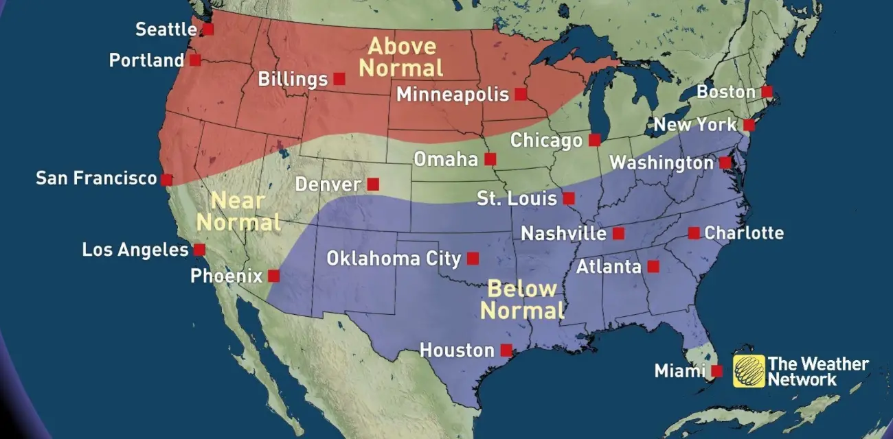
While milder than normal weather is expected to dominate December for the northern half of the country, more typical wintry weather is likely to emerge in January and especially February from the Great Lakes to the Mid-Atlantic States.
The expected winter weather pattern is partly due to strong El Niño conditions that will leave a large footprint across much of the United States. A significant driver of this year’s Winter Forecast, this El Niño event is establishing itself as one of the strongest since 1950.
“Winter will start with typical El Niño characteristics across the country, but unique aspects of this El Niño could make for some harsher winter weather in the New Year,” said Chris Scott, Chief Meteorologist at The Weather Network.
“Cold weather will take a bit longer than usual to set in across the Midwest and Northeast as mild Pacific air will dominate the country during December. However, the threat for winter storms will increase across the Mid-Atlantic and Northeast during the second half of the season when arctic air is more likely to sneak in from the north. Meanwhile, wetter than normal conditions from the Southwest to the Southeast will keep these regions on the cooler side of normal throughout the winter months.”
Above normal temperatures are expected from the Pacific Northwest, across the northern Plains and into the Upper Midwest with fewer outbreaks of arctic air. In a tale of two winters across the Ohio Valley and Mid-Atlantic region, winter will start on the mild side but finish with a colder bite. Meanwhile, the southern tier of the country will generally average below normal for temperatures, largely due to increased cloud cover and precipitation.
Typical of El Niño, an active storm track is on the horizon for the southern tier of the country and up the East Coast bringing above average precipitation for these areas. While this storm track will deliver beneficial moisture to southern California, those who reside along the Gulf Coast and especially Florida are more likely to see severe storms. Residents from the southern Plains to the Mid-Atlantic and into New England should plan for an increased threat of wintry weather, especially during the second half of the season. In contrast, less snowfall and overall drier than normal conditions are expected from the Pacific Northwest to the central Great Lakes.
Complete Winter Forecast details, including regional breakdowns, maps and charts are available here.
Copyright © 2024 EYT Media Group, Inc. All rights reserved. Any copying, redistribution or retransmission of the contents of this service without the express written consent of EYT Media Group, Inc. is expressly prohibited.


